Surrey Three Peaks Challenge Route

The Surrey Three Peaks route is 22-miles (36km), with 1060 metres of ascent, taking in parts of the North Downs Way, Leith Hill Greenway, Mole Gap Trail, Pilgrim's Way, and the Greensand Way. This is also the set route of our Open Surrey Three Peaks Challenge events. Various other diversions are available, as there are so many paths in the area.

After heavy rain, routes to Box Hill via the stepping stones and footbridge can be flooded! In this case the quickest alternative is to follow the path ascending behind the Burford Bridge Hotel.
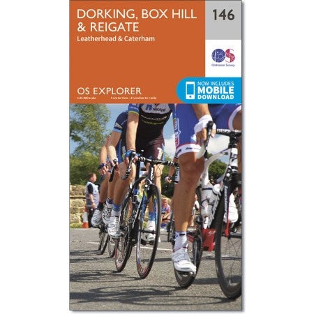
The OS Explorer 146 Map includes the complete Surrey Three Peaks route - as above, the route combines sections of the North Downs Way, Leith Hill Greenway, Mole Gap Trail, Pilgrim's Way and the Greensand Way.

From earlier versions, the route has been adapted to avoid ascending up to Ranmore at White Downs, and instead cut through Westcott further east - this has slightly reduced the long trek from the south, heading more directly towards Denbies and Box Hill. The Greensand Way is also taken more directly to Leith Hill.

Surrey 3 Peaks Maps

OS Explorer 146 for the Surrey Three Peaks

Surrey Three Peaks Map Cover

Buy the Surrey 3 Peaks Map from the Three Peaks Shop

Please don't bring single-use plastics

Help preserve the beauty of our landscapes by not bringing single-use plastics to the area.

Follow the Countryside Code.


Three Peaks Challenge Ltd logo®

Contact Bookings & upcoming events

Copyright © 2024 Three Peaks Challenge Ltd. Page last updated at 13:02, on the 21st January 2024.

Three Peaks Challenge Ltd is a company registered in England and Wales. Our company registration number is 06993751. Our VAT registration is GB998704845.
The Three Peaks Challenge Logo is a registered trademark of Three Peaks Challenge Ltd.