
OS Explorer 392 map for Ben Nevis
Map and route reference for Ben Nevis and Fort William.
Ben Nevis is the tallest mountain in the United Kingdom, at 1345 metres (4413 feet) in height, and is therefore the largest of the National Three Peaks of Great Britain.
Height
1,345m (4,413ft)
UK's highest
Grid Reference
NN 166 712
Ascent Time
3.5 - 5 hours
Round Trip
17km (10.5 miles)
Ben Nevis has one main path, the Pony Track or "Tourist Path", marked on the OS Explorer 392 Map (at the Three Peaks Shop). Unlike Snowdon and Scafell Pike, the path to Ben Nevis starts close to sea level, meaning much greater vertical ascent.
The postcode for the Ben Nevis Visitor Centre car park is PH33 6ST. Parking here is £3 for cars, and £10 for minibuses and coaches. More parking options →
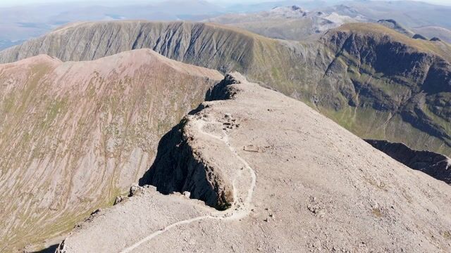
A main path runs up Ben Nevis, from Glen Nevis, which can be followed from either Glen Nevis Youth Hostel, or the Glen Nevis Visitor Centre. Early on the two paths join, and then continue to a Loch - Lochan Meall an t-Siudhe. From this half way point, the path follows a zigzag pattern to the rocky summit plateau. Large cairns mark the final ascent to the trig point which marks the peak - snow will often nearly obscure these cairns until around May each year.
Popularly known as The Pony Track, this route is 10.5 miles long, 17km, up and down, and includes 1352 metres of ascent. All routes →
The main route in red below shows the full route from the Glen Nevis Visitor Centre. The alternative start in blue shows the route beginning at the Glen Nevis Youth Hostel.
Download the GPX routes for the Glen Nevis Visitor Centre start and the Glen Nevis Youth Hostel start.
Map and route reference for Ben Nevis and Fort William.