
Three Peaks Challenge Ltd logo
Book Contact
Book
Login / Manage
  • Scafell Pike Overview
  • Parking
  • Routes
    • From Wasdale Head
    • From Seathwaite
  • Weather & Conditions
  • Facts & History
  • Accommodation

  • ← National Three Peaks Challenge
  • Ben Nevis
  • Snowdon / Yr Wyddfa
Three Peaks Challenge Ltd logo
Resources Search Photos Manage Your Booking Log in Create an account
Book your challenge
Contact us

Email us directly

[email protected]
Open mail app

Open contact form

National Three Peaks Challenge

Ben Nevis, Scafell Pike, Snowdon

23 miles • 3064m ascent • 3 stages

Routes & Mountains

  • Ben Nevis
  • Scafell Pike
  • Snowdon / Yr Wyddfa
  • Driving route

Prepare

  • Kit list
  • Accommodation
  • Food & drink
  • Travel to Fort William

Information

  • FAQs
  • How hard is it?
  • Plan your own
  • Photos
Guided challenges Book your place 3 Peaks in 3 Days Private groups

Yorkshire Three Peaks Challenge

Ingleborough, Whernside, Pen-y-ghent

24 miles • 1585m ascent • continuous

Routes & Mountains

  • Walking route
  • Pen-y-ghent
  • Whernside
  • Ingleborough

Prepare

  • Kit list
  • Accommodation
  • Food & drink

Information

  • FAQs
  • How hard is it?
  • Plan your own
  • Photos
Guided challenges Book your place Private groups

Surrey Three Peaks Challenge

Box Hill, Holmbury Hill, Leith Hill

23 miles • 1060m ascent • continuous

Routes & Mountains

  • Walking route
  • Box Hill
  • Holmbury Hill
  • Leith Hill

Prepare

  • Kit list
  • Accommodation
  • Food & drink

Information

  • FAQs
  • How hard is it?
  • Plan your own
  • Photos
Guided challenges Book your place Private groups

Welsh Three Peaks Challenge

Snowdon, Cadair Idris, Pen y Fan

17 miles • 2334m ascent • 3 stages

Routes & Mountains

  • Snowdon / Yr Wyddfa
  • Cadair Idris
  • Pen y Fan
  • Driving route

Prepare

  • Kit list
  • Accommodation
  • Food & drink

Information

  • FAQs
  • How hard is it?
  • Plan your own
  • Photos
Guided challenges Book your place Private groups
Private events Fundraising events Charities Companies & Corporates Training guides Routes Photos Resources & policies Other challenges Shop
View all dates

Scafell Pike Routes

Scafell Pike has several routes to its 978-metre summit. The Wasdale Head route via Hollow Stones is the most popular and the route used for Three Peaks Challenges. Alternative routes from Seathwaite, Langdale and Eskdale are longer but offer different perspectives of England's highest mountain.

Wasdale Head via Hollow Stones

The Wasdale Head route is the shortest and most direct path to the summit of Scafell Pike. Starting from the Lake Head car park at Wasdale Head, the route follows Lingmell Gill before ascending via Brown Tongue to Hollow Stones, where a final steep section leads to the summit plateau.

This is the standard route used for National Three Peaks Challenge events, particularly for night ascents when the shortest route is essential.

From Wasdale Head

Distance 6 miles (10km) round trip
Ascent 989 metres
Time 4-6 hours

The shortest and most direct route, used for Three Peaks Challenges.

View route details

From Seathwaite

Distance 9 miles (14.5km) round trip
Ascent 900 metres
Time 6-8 hours

A longer approach from Borrowdale via the Corridor Route.

View route details

Summit Navigation

The summit area of Scafell Pike is a broad boulder field that can be confusing in poor visibility. Cairns mark the main paths but can be difficult to follow in mist or darkness. A compass, map and torch are essential, particularly for night ascents during the Three Peaks Challenge.

The summit itself is marked by a large cairn built on top of the highest point. In clear conditions, views extend to the Isle of Man, the Mourne Mountains, Wales and Scotland.

Scafell Pike on the Three Peaks Challenge

Scafell Pike is typically the second peak on a National Three Peaks Challenge, climbed between Ben Nevis and Snowdon. Many groups tackle Scafell Pike during the night, making the Wasdale Head route the natural choice as it is the shortest and most straightforward to navigate in the dark.

The drive from Fort William to Wasdale Head is approximately 4.5-5 hours. After descending Scafell Pike, the drive to Pen-y-Pass for Snowdon is approximately 3.5-4 hours.

Alternative Routes (Not for Three Peaks)

Several alternative routes reach the summit of Scafell Pike. These are longer than the Wasdale Head approach and are not typically used for Three Peaks Challenges, but offer rewarding walks in their own right.

From Seathwaite via Corridor Route

Starting from Seathwaite Farm in Borrowdale (CA12 5XJ), this route approaches Scafell Pike from the north via Styhead Tarn and the Corridor Route. The Corridor Route traverses beneath Great Gable and Lingmell, offering dramatic views of the surrounding peaks.

Distance 9 miles (14.5km) round trip
Ascent 900 metres

View the full Seathwaite route guide →

From Langdale

A longer approach from the Old Dungeon Ghyll car park in Great Langdale, crossing Rossett Ghyll to Angle Tarn and Esk Hause before the final ascent. This is a full day's walk and not suitable for Three Peaks timing.

From Eskdale

The quietest approach, from the Woolpack Inn or Brotherilkeld in upper Eskdale. This route ascends via the River Esk and the upper basin below Scafell Pike. Remote and demanding, requiring good navigation.

When to Climb

Scafell Pike can be walked year-round, but conditions vary by season:

  • Summer (June-August): Longest days, generally best conditions, but summit can still be cold and windy
  • Spring (April-May): Variable weather, snow possible on upper sections, days lengthening
  • Autumn (September-November): Shorter days, wetter conditions, early snow possible from November
  • Winter (December-March): Snow and ice likely on upper sections, short daylight hours, ice axe and crampons may be needed

Three Peaks Challenges run primarily from April to October. Night ascents are common as Scafell Pike is often the second peak, tackled in darkness.

Scafell Pike maps

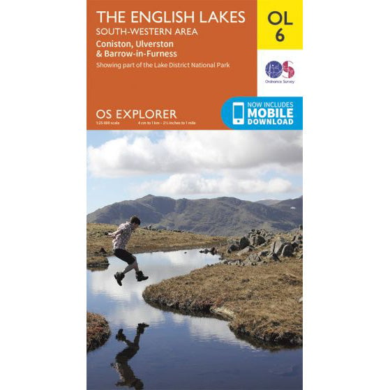
OS Explorer OL6 map for Scafell Pike
Choose format

OS Explorer OL6 map for Scafell Pike

Coverage for Scafell Pike and the South Western Lakes.

19 in stock £9
Buy standard map
17 in stock £13
Buy waterproof map
  • Scafell Pike Overview
  • Parking
  • Routes
    • From Wasdale Head
    • From Seathwaite
  • Weather & Conditions
  • Facts & History
  • Accommodation

  • ← National Three Peaks Challenge
  • Ben Nevis
  • Snowdon / Yr Wyddfa
We are Three Peaks Challenge
16 years experience
56,000+ participants
In-house transport & logistics
£2.3m+ raised for charity

Events

  • Upcoming dates & prices
  • National Three Peaks
  • Yorkshire Three Peaks
  • Welsh Three Peaks
  • Surrey Three Peaks
  • Private group bookings

Training

  • Training overview
  • Which Three Peaks to do?
  • 8-week training plan
  • 12-week training plan
  • Pace calculator
  • Training hikes by region

Fundraising

  • Charity challenges
  • Fundraising for a charity
  • Set a fundraising target
  • Team fundraising ideas
  • Gift Aid explained
  • Corporate matching

Charities

  • Charities hub
  • Private charity events
  • Pricing & sponsorship
  • Promotion toolkit
  • Charities FAQs
  • Charity partners

Companies

  • Company events
  • SME teams (8-30)
  • Large teams (50-200)
  • Team building
  • Private events explained
  • Company fundraising plan

Support

  • Contact
  • Manage your booking
  • Resources
  • Routes & GPX
  • Kit lists
  • Three Peaks shop
National Three Peaks
Yorkshire Three Peaks
Welsh Three Peaks
Surrey Three Peaks

What do you think of this page?

Three Peaks Challenge Ltd logo

© 2026 Three Peaks Challenge Ltd.

Company incorporated in England & Wales in 2009. Company number: 06993751 VAT registration: GB998704845.
Registered office: Trade Fair House 2 West Court, Enterprise Road, Maidstone, Kent, England, ME15 6JD.
The Three Peaks Challenge Logo is a registered trademark of Three Peaks Challenge Ltd.
Contact us - Recruitment - Pricing - Developers & API - Agentic commerce