
Three Peaks Challenge Ltd logo
Book Contact
Book
Login / Manage
  • Snowdon / Yr Wyddfa Overview
  • Parking
  • Routes
    • Pyg Track
    • Llanberis Path
    • Miners Track
    • Watkin Path
    • Snowdon Ranger
    • Rhyd Ddu Path
    • Crib Goch
  • Weather & Conditions
  • Facts & History
  • Accommodation

  • ← National Three Peaks Challenge
  • Ben Nevis
  • Scafell Pike
Three Peaks Challenge Ltd logo
Resources Search Photos Manage Your Booking Log in Create an account
Book your challenge
Contact us

Email us directly

[email protected]
Open mail app

Open contact form

National Three Peaks Challenge

Ben Nevis, Scafell Pike, Snowdon

23 miles • 3064m ascent • 3 stages

Routes & Mountains

  • Ben Nevis
  • Scafell Pike
  • Snowdon / Yr Wyddfa
  • Driving route

Prepare

  • Kit list
  • Accommodation
  • Food & drink
  • Travel to Fort William

Information

  • FAQs
  • How hard is it?
  • Plan your own
  • Photos
Guided challenges Book your place 3 Peaks in 3 Days Private groups

Yorkshire Three Peaks Challenge

Ingleborough, Whernside, Pen-y-ghent

24 miles • 1585m ascent • continuous

Routes & Mountains

  • Walking route
  • Pen-y-ghent
  • Whernside
  • Ingleborough

Prepare

  • Kit list
  • Accommodation
  • Food & drink

Information

  • FAQs
  • How hard is it?
  • Plan your own
  • Photos
Guided challenges Book your place Private groups

Surrey Three Peaks Challenge

Box Hill, Holmbury Hill, Leith Hill

23 miles • 1060m ascent • continuous

Routes & Mountains

  • Walking route
  • Box Hill
  • Holmbury Hill
  • Leith Hill

Prepare

  • Kit list
  • Accommodation
  • Food & drink

Information

  • FAQs
  • How hard is it?
  • Plan your own
  • Photos
Guided challenges Book your place Private groups

Welsh Three Peaks Challenge

Snowdon, Cadair Idris, Pen y Fan

17 miles • 2334m ascent • 3 stages

Routes & Mountains

  • Snowdon / Yr Wyddfa
  • Cadair Idris
  • Pen y Fan
  • Driving route

Prepare

  • Kit list
  • Accommodation
  • Food & drink

Information

  • FAQs
  • How hard is it?
  • Plan your own
  • Photos
Guided challenges Book your place Private groups
Private events Fundraising events Charities Companies & Corporates Training guides Routes Photos Resources & policies Other challenges Shop
View all dates

Snowdon Pyg Track

The Pyg Track is the most popular route up Snowdon for Three Peaks Challenge groups. Starting from the Pen-y-Pass car park on the A4086, the route ascends directly to the summit at 1,085 metres with outstanding views across Eryri (Snowdonia) National Park.

Route Summary

Distance 7 miles (11km) round trip
Ascent 723 metres (2,372 feet)
Typical Time 4-6 hours round trip
Difficulty Strenuous, rocky with some scrambling near the top
Start Point Pen-y-Pass car park (LL55 4NY)
Grid Reference SH 647 557

Route Map

Elevation profile of the Snowdon Pyg Track route

Loading elevation profile…
Elevation profile for the Snowdon Pyg Track.

Route Description

From the Pen-y-Pass car park, the Pyg Track leaves from the higher level area of the car park. The path begins briefly as tarmac before becoming a well-made stone path ascending south-west above the Llanberis Pass.

The initial section traverses the hillside with views down to Llyn Peris and across to the Glyderau range. The path is clear and well-maintained, climbing gradually at first before steepening.

As you gain height, the terrain becomes rockier. The path passes Bwlch y Moch (the Pass of the Pigs, which gives the track its name) before continuing to climb towards the summit ridge.

A large upright stone approximately half an hour from the top marks the junction with the Miners Track joining from the left. Beyond this point, the path steepens considerably with some sections requiring light scrambling (using hands for balance).

A second marker stone below the final ascent points you towards the summit. The last section is steep and rocky but well-cairned. The summit features the Hafod Eryri building and the trig point marking the highest point in Wales.

Key Waypoints

  1. Pen-y-Pass car park (359m altitude) - Start from the upper level of the car park
  2. Bwlch y Moch (500m) - The Pass of the Pigs, rocky terrain begins
  3. Miners Track junction (850m) - Large standing stone marks the junction
  4. Final scramble (900-1,050m) - Steepest section, some hand-use needed
  5. Summit marker stone (1,050m) - Final push to the top
  6. Summit / Yr Wyddfa (1,085m) - Hafod Eryri summit building and trig point

Navigation Notes

In good visibility, the Pyg Track is clear and well-cairned throughout. In cloud, the upper sections can be confusing where the path crosses areas of bare rock. The junction with the Miners Track is marked by a large standing stone - an important landmark for descent.

The summit area has the Hafod Eryri building as a clear landmark, but in thick cloud the surrounding drops can be dangerous. Take care near the northern edge of the summit ridge.

Download GPX Route

Download GPX Route

Use this GPX file with your GPS device or smartphone navigation app. The route shows both the ascent and descent via the Pyg Track.

Parking

Pen-y-Pass car park is the starting point for the Pyg Track. Parking must be pre-booked via JustPark, costing from £18 for 8 hours. The postcode is LL55 4NY.

Full parking information →

Snowdon maps

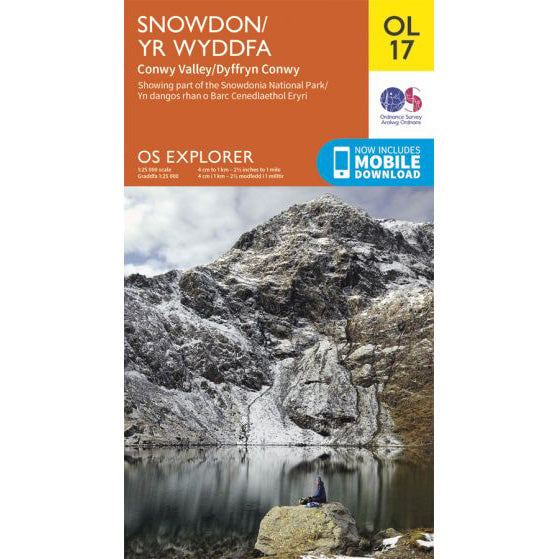
OS Explorer OL17 map for Snowdon
Choose format

OS Explorer OL17 map for Snowdon

Route support for Snowdon and surrounding paths.

19 in stock £9
Buy standard map
10 in stock £13
Buy waterproof map
  • Snowdon / Yr Wyddfa Overview
  • Parking
  • Routes
    • Pyg Track
    • Llanberis Path
    • Miners Track
    • Watkin Path
    • Snowdon Ranger
    • Rhyd Ddu Path
    • Crib Goch
  • Weather & Conditions
  • Facts & History
  • Accommodation

  • ← National Three Peaks Challenge
  • Ben Nevis
  • Scafell Pike
We are Three Peaks Challenge
16 years experience
56,000+ participants
In-house transport & logistics
£2.3m+ raised for charity

Events

  • Upcoming dates & prices
  • National Three Peaks
  • Yorkshire Three Peaks
  • Welsh Three Peaks
  • Surrey Three Peaks
  • Private group bookings

Training

  • Training overview
  • Which Three Peaks to do?
  • 8-week training plan
  • 12-week training plan
  • Pace calculator
  • Training hikes by region

Fundraising

  • Charity challenges
  • Fundraising for a charity
  • Set a fundraising target
  • Team fundraising ideas
  • Gift Aid explained
  • Corporate matching

Charities

  • Charities hub
  • Private charity events
  • Pricing & sponsorship
  • Promotion toolkit
  • Charities FAQs
  • Charity partners

Companies

  • Company events
  • SME teams (8-30)
  • Large teams (50-200)
  • Team building
  • Private events explained
  • Company fundraising plan

Support

  • Contact
  • Manage your booking
  • Resources
  • Routes & GPX
  • Kit lists
  • Three Peaks shop
National Three Peaks
Yorkshire Three Peaks
Welsh Three Peaks
Surrey Three Peaks

What do you think of this page?

Three Peaks Challenge Ltd logo

© 2026 Three Peaks Challenge Ltd.

Company incorporated in England & Wales in 2009. Company number: 06993751 VAT registration: GB998704845.
Registered office: Trade Fair House 2 West Court, Enterprise Road, Maidstone, Kent, England, ME15 6JD.
The Three Peaks Challenge Logo is a registered trademark of Three Peaks Challenge Ltd.
Contact us - Recruitment - Pricing - Developers & API - Agentic commerce